
NW Trip.1.Day.1. Rhinogs. Moelfre, Y Llethr, Crib Y Rhiw, Diffws & West Top (4 x Nuttalls, Rhinogs).
- dai186
- Aug 22, 2020
- 3 min read

Updated: Oct 3, 2020
A week long trip to the Western coastline of North Wales and the Lleyn Peninsula.
This was a week long sojourn up the Western Welsh coast and then into the Lleyn Peninsula to knock off primarily Marilyns but you could not really avoid doing a few Nuttalls along the way.
30.7.2020 - Moelfre 589m (Marilyn), Y Llethr 756m, Crib Y Rhiw 679m, Diffws 750m and Diffws West Top 642m (Nuttalls).
The last Marilyn in the Rhinogs area. Moelfre is just east of Talybont near Barmouth. I stayed the night at Parc Isaf Farm, a delightful farm campsite with full facilities but due to Covid the toilets and wash area was not in use. £12 paid for just an overnight stay/security really!!
Anyway from the farm head East or right when you come out of the campsite. You go on the road for just over a km until you come to a bridleway which you continue to follow East for another two km’s until you come to another gate at the bottom of Moelfre. Simple go through this gate and another on the left and start heading North up the steep bank of Moelfre. It’s about one km and a 300m pull to the top. I cut across country a bit but the easiest thing to do is to follow the fence line to the top and hop over the style to the summit cairn. It took me 1hr 30min, 4.75km and 482m of ascent to get here.
I had done Llethr, Crib Y Rhiw, Diffwys and Dyffwys West Top before but I decided to make a decent hike of it today so I hauled my butt the near five km’s East to Llethr and simply headed South/South West then to take in the others. All pretty much over unmaintained but discernible trails on a gorgeous ridgeline with stunning views all around towards Rhingog Fawr and Fach, Barmouth and the Irish Sea. Such a beautiful day for it too. I forgot to mention this is stone wall country so the way is easy to find.
I headed off the ridge North at spot height 572 just East of Llyn Irddyn where there is a good well marked trail down to the quaint bridge of Pont Scethin. Once here you simply follow the trail West until you join your morning trail at the point where you start to climb up Moelfre. From there it is an easy downhill four kms back to the start point.
Parking: At Parc Isaf farm if you are staying there otherwise there is a small (5-7 cars) car park at the first bridleway gate at the end of the road. It is a popular hike though so get there well early.
Route Summary: Bridleways, good and bad mountain trails, rocky in places but very good walking. Would be wet in winter.
Route Statistics: 21.7km’s, 1,050m of height gain done in an all in time of 6hr 45mins. Quite slow as I stopped and talked to a few people and due to the heat I had ample rest stops.
GPX files: For gpx files go to the Peakbagger website by following these links and go to the bottom right hand of the page and click ‘Download this GPS track as a GPX file.’
Ascent Entry on Peakbagger: Moelfre

Route overview using ViewRanger


Good hard standing at Parc Isaf Farm otherwise there is a small car park at the start of the route.

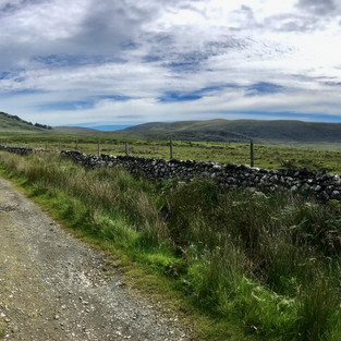


Some of the beautiful scenery on the way around the route.


Comments