NW Trip No.2 Day 4. Mynydd Enlli, an Island Marilyn (Bardsey Island, Lleyn Peninsula).
- dai186
- Aug 22, 2020
- 3 min read
Updated: Oct 3, 2020
15.8.2020 - Bardsey Island, Mynydd Enlli 167m (Marilyn), Lleyn Peninsula.
A day out picking off a Marilyn that is hard to get to on Bardsey Island off the Lleyn Peninsula due to restricted summer ferry services during Covid.
Mynydd Enlli at 167m is the most Westernmost Marilyn on the Lleyn Peninsula and is on Bardsey Island situated right on the tip of the Peninsula. It is also only accessible between April and September due to the ferries not running in winter. This year due to Covid19 access was restricted even more with the ferries only resuming service in August.
To book a day trip (there are stays available too) you can either go on the Bardsey Island web site (https://www.bardsey.org/book) or phone ‘Colin’ on 07971 769895. Payment is taken by cash on the day of the trip. It is £35 per person.
Parking for our trip was the main car park in Aberdaron. Plenty of room there but this is a busy seaside town and the car park fills very quickly in the day. All day parking was £4 pay and display. There is another car park available however, namely a farmer’s field back up the hill coming into town.
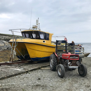
From Aberdaron you head out on the coastal path and head South for the beautiful twenty minute walk to Porth Meudwy. A small inlet some two kilometres away. Once there your small ferry, it seats about ten people maximum, will take you out to the island in about another twenty minutes. The landing point being a small slipway on the Southern edge of the island marked as Carn Enlli on your OS map.
Having a four hour window before the return ferry we decided to walk the island in a figure of eight to get a decent walk out of it. From the slip way you head NE on a track to the obvious bulk of Mynydd Enlli. The island is pretty much flat apart from the hill. You hit a small farm and then head up the Southern flank of Enlli. The views of the island is stunning and it is not long before you get up to the ridgeline and to the large rock that marks the summit.
Dropping down the Northern flank there are great views of the Aberdaron headland and you then get to the track that cuts the island in two. Along this track are the few main buildings of the island. There are a few houses, homesteads, monuments, a couple of small tourist shops and toilets. All very quaint and beautiful .
We then carried on past the arrival slipway out towards the Southern tip of the island to the lighthouse, returned and then walked North along a path on the Western edge. This reconnected to the central track again which we walked down again back to the slipway where we finished. This was simply a beautiful weather day that had us doing a gorgeous walk on a stunning, historical Welsh island.
Parking: Pay and display at Aberdaron. £4 per day day or a farmer’s field up the hill for £3.
Route Summary: A gorgeous small island walk with great views along footpaths and a wide farm track with very little height gain. Be wary of the cliff edges but as long as you follow the gpx trail you will be fine.
Route Statistics: 9km and 218m height gain in a leisurely 3hrs 15min.
GPX files: For gpx files go to the Peakbagger website by following these links and go to the bottom right hand of the page and click ‘Download this GPS track as a GPX file.’
Ascent Entry on Peakbagger: Mynydd Enlli
Route overview using ViewRanger and some island information.
The trip out to Bardsey and the landing slipway.
Beautiful Bardsey Island.


Comments