Llangorse Lake loop. Mynydd Llangorse, Mynydd Troed and Allt Yr Esgair (Brecon Beacons).
- dai186
- Oct 18, 2017
- 3 min read
Updated: Oct 3, 2020
Llangorse Loop - Originally done 18.10.2017. Photos August 2020.
Mynydd Troed 609m, Mynydd Llangorse 515m and Allt Yr Esgair 393m. Brecon Beacons.
I started this website over a year after I started my peak bagging quest started in earnest so some of my earlier Welsh hills have not been entered on here. When I get time I will add some of the earlier routes that are worthy of inclusion. This is one such route because it takes in three Marilyns and it is a beautiful local route that I do quite frequently. In this instance the hike was done on the 18.10.2017 but I have used photos from a blue sky summer day in August 2020.
The route starts at Llangorse lake where there are toilets, a cafe and plenty of parking. The first leg to the foot of Mynydd Troed is a 4km road stretch but once to the foot of the hill that is the last of the road. Then there is a small farm gate which leads you onto the hill. The pull up Mynydd Troed is steep and the ferns there are extensive in the summer months. Follow my gpx track and you won’t go far wrong.
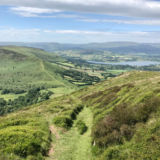
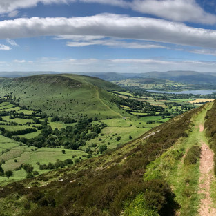
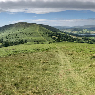
The views from Mynydd Troed are simply stunning, the Beacons are plainly in sight, there is the lake, the manicured fields and other nearby hills and vales. It is simply gorgeous. You come off the back of the hill (South) on a very steep path that leads to a pass/unclassified road. There you go straight over and up a well trodden path up Cockit Hill that takes you onto Mynydd Llangorse and its Trig Point.
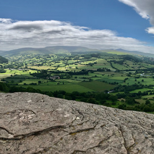
Once at the TP there is a long plateau walk of around 4.5kms that drops down to the village of Bwlch. Here you walk along the A40 out of the village and leave it on the first sharp bend on an UC road. You go round the first bend and shortly after you will see a half hidden gateway on the left hand side. Go through the gate and you enter a tree covered Roman Road that takes you the 2kms to bottom of the ridge that leads to the top of Allt Yr Esgair which is an Iron Age fort. The views from here are also first class as you now overlook the Usk valley, one of the most beautiful valleys in Wales. Directly over the valley are Brecon Beacons. It is a superb rest location and it is worth savouring the views here.
Once done you drop off the North side of the ‘Allt’ on well signposted trails to another UC road. You turn right and then immediately left towards Tymawr farm where again you pick up well signposted paths that take you around the lake back to the start point. Do follow the gpx track as it is accurate.
Parking: Plenty at the start point. A large gravel car park and grass parking. Toilets and a cafe/shop.
Route Summary: A 4km road hike, hike through ferns (summer months) and there after well defined mountain trails and well signposted paths. A beautiful hike in the middle of the Brecon Beacons taking in superb views.
Route Statistics: 22km with 800m of height gain with an all in time of 6 hours. Take your time, it is worth it!
GPX files: For gpx files go to the Peakbagger website by following these links and go to the bottom right hand of the page and click ‘Download this GPS track as a GPX file.’
Ascent Entry on Peakbagger: Mynydd Troed

Route Overview using ViewRanger. Start at Llangorse lake at the telephone sign.
The views on the way round are simply stunning.


Comments