Peak & Lake District Sojourn. Day 17.
- dai186
- Jun 11, 2021
- 2 min read
Muncaster Fell 231m, Ravenglas (Marilyn).
Summary
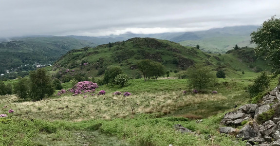
The weather is still not much better so today it was pick something below the cloud level so Muncaster Fell it was. An English Marilyn and a pretty one at that.
Parking was in a large car park which is used to access Muncaster castle on the A595. The castle is on the other side of the road. The car park is large, free with no height restrictions.
There is a lane/bridleway on the top right of the car park and you simply follow this on a dog leg where it joins onto Fell Lane. You simply follow this lane all the way to where you come out of the woods. The main bridleway then veers to the right but there is a footpath going off left which takes you to the trig pointed top. Now this is not the actual summit, this is actually on a nearby rocky knoll and easy to get to. It is marked on my OS overview map.
To make it a bit more of a walk I carried on along the dragon’s type boggy back of Muncaster Fell to bag Silver Nott hill as well. I then dropped down to Muncaster Head farm and followed a good track/road all the way back to the A595 where I then walked all the way back to the start.
Note: You will have about a km to walk on a fairly busy road here before you have pavement access. It is quite restricted otherwise there is an alternative footpath at Raw Crag you could try.
Parking: Large, free with no height restrictions.
Route: Good bridleways, a back road, a main road and mountain trails with some boggy patches.
Route Statistics: A 12.5km, 400m bimble in 3 hours.
Info sheets
First section to the trig point which remember is not the summit.
Views for the dragons back section.


Comments